File:Meteo areas chart.png
From HFUnderground
(Difference between revisions)
(Chart displaying the metero report areas around France and the United Kingdom. Category:Images) |
|||
| Line 1: | Line 1: | ||
| - | Chart displaying the metero report areas around France and the United Kingdom. | + | Chart displaying the metero report areas around France, Ireland and the United Kingdom. |
[[Category:Images]] | [[Category:Images]] | ||
Revision as of 09:22, 25 July 2010
Chart displaying the metero report areas around France, Ireland and the United Kingdom.
File history
Click on a date/time to view the file as it appeared at that time.
| Date/Time | Thumbnail | Dimensions | User | Comment | |
|---|---|---|---|---|---|
| current | 09:19, 25 July 2010 | 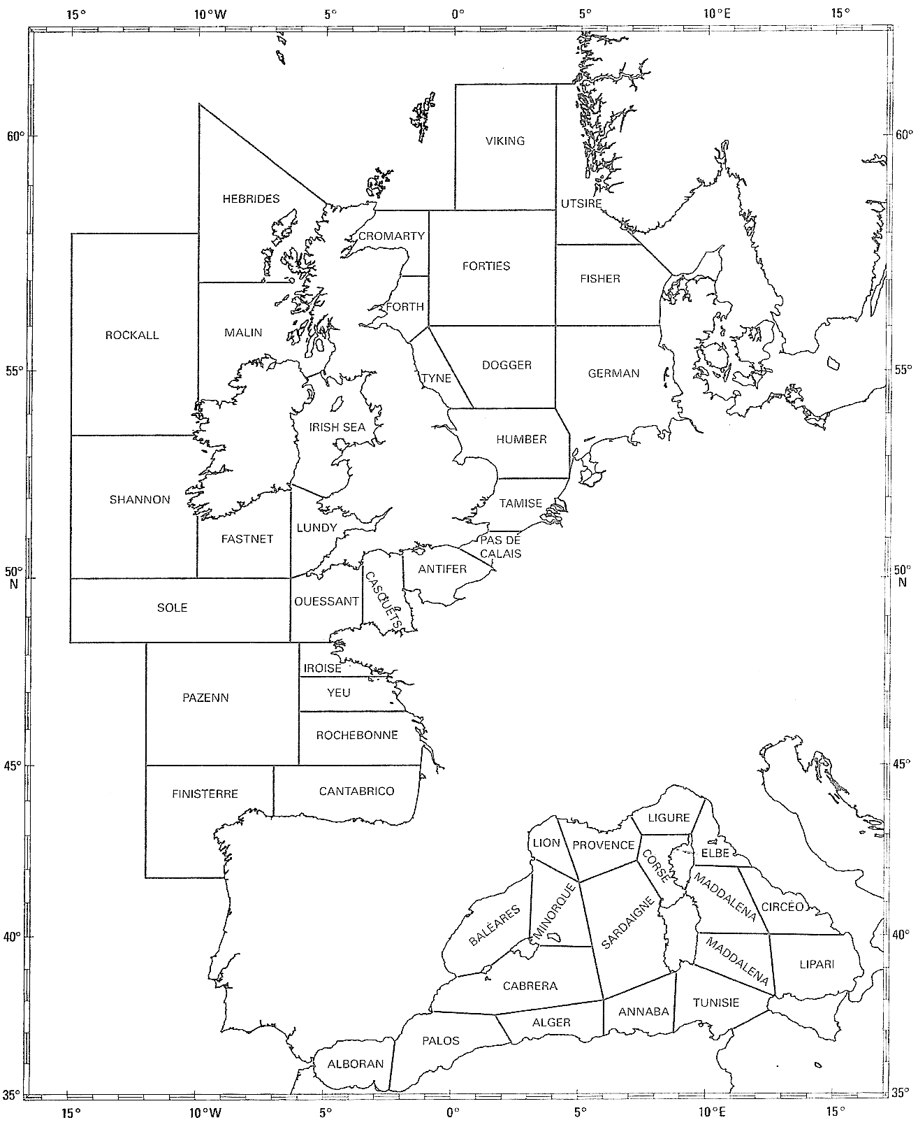 | 1,314×1,612 (120 KB) | Strange Attractor (Talk | contribs) | (Chart displaying the metero report areas around France and the United Kingdom. Category:Images ) |
- Edit this file using an external application (See the setup instructions for more information)
File links
The following 2 pages link to this file:


